|
|
Catalog Search Support |

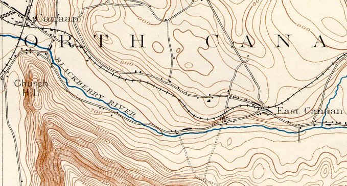
| It is interesting to see the rather small topographic impact the Iron business made at the years when it was at its peak. Despite the fact that the three maps on this page are in different scales, the first two are most notable for what is NOT shown in the Beckley area. | |
|
|
|
| Above, from the Sheffield Quadrangle, 1897 (15 minute series), USGS | |
| On this map, Beckley is found at the road
intersection an inch or so southwest (left) of the East Canaan village, on
the Blackberry River. Assuming that the map above is accurate
(generally a poor assumption for any topo map done before the advent of
photographic confirmation by air of field mapping), the devastation
of the 1896 fire must have been extraordinary, eliminating most structures
on both sides of the road.
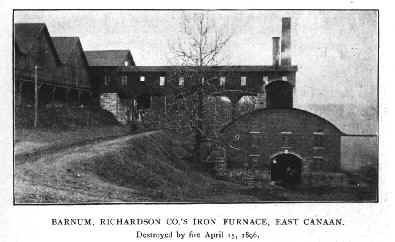
In the photo on the right, the furnace can be seen peeping out above the building on the right (with the rounded top). The stone wall still present on the uphill side of the road is visible in this picture in the left center. (The photo is from Scrap Book of North Canaan, published circa 1897) |
 |
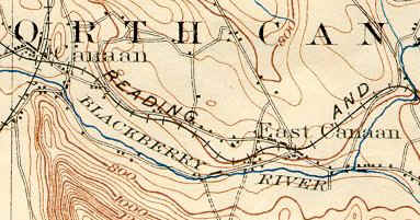 |
It's this kind of thing that makes one question old topographic maps! Although the scale is larger, the 1900 "remapping" of the area shows NO additional structures on the Beckley site, even though we know that the supporting structures had been rebuilt and the furnace had been back in blast for some time before 1900. One wonders if the surveyors did not just say "Oh, just some factory buildings there..." and decide to re-use the 1897 survey. |
| above, from the Housatonic Quadrangle, 1900 (30 minute series), USGS | |
 |
|
| Above from the Ashley Falls Quadrangle, 1949 (7 1/2 minute series), USGS | |
| There's clearly more detail present in the 1949 map, as would be expected given the scale of this map, but also given the fact that by this time surveys were subjected to at least limited comparison with aerial photographs. Viewed from the ground, however, even this more accurate map raises questions. For example, where is the Beckley furnace? Where is the residence adjacent to the former paymaster's office (which appears to be the sole building on the river side of Lower Road in this area)? | |
![]() to go to our Iron page
to go to our Iron page
|
|
||
|
Find us on Facebook |
|
Between the Lakes Group is located at 372 Between the Lakes Road, in Salisbury, Litchfield County, Connecticut. More specifically, we're in Taconic -- a hamlet in the Twin Lakes area of the Town of Salisbury. Questions about us or about our products? Go to our Frequently Asked Questions page.
|